
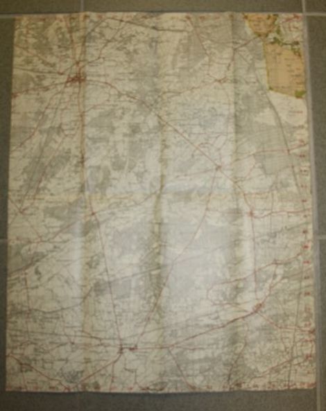
WW2 Dutch map of Herenthals
This is a paper map that measures about 35 x 40 cm ( about 14 x 16 inches).
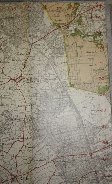
Shown is the area South West of Eindhoven, Herenthals that is in Belgium.
However, the map belongs to a set of Dutch maps.
Herenthals indicates the area shown on the map.
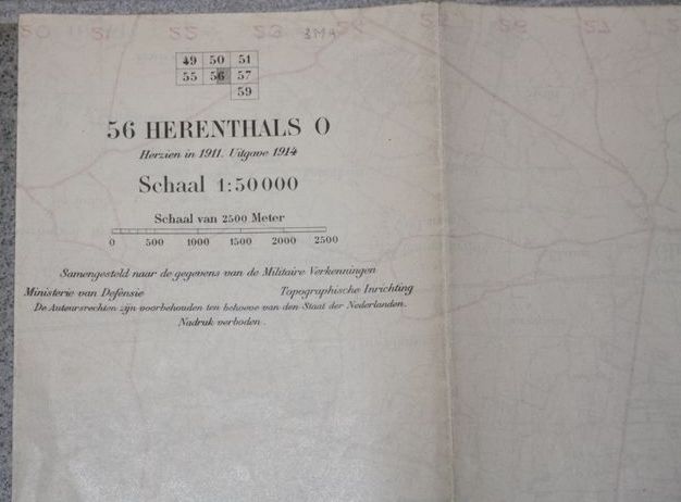
Beautiful marked on the back with map specifications.
Scale is 1/50.000.
It was issued in 1914.
Map is in used condition, but still very interesting because of the covered area.
Used by the Dutch Army during 1940, but issued during WW1.
€17,50
Availability: 1 in stock
SKU
081120-L2123
Categories Militaria, Printed items - Dutch, Shop
Tags dutch, herenthals, map, road, west, WW1, WW2